|
|

|
||||||||||
10th
Edition of Pinedale OFFline |
||||||||||
|
Instead of our usual April Fool's Day spoof edition, we decided to take a trip back in time and showcase some of the real stories that occurred in our area over the years that helped shape Pinedale and Sublette County, Wyoming. Our 10th edition of Pinedale OFFline takes a look at where we came from to help us understand who we are today. |
|||||||||
Seventh
Biennial Report of the State Engineer to the Governor
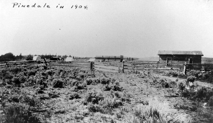
of Wyoming From Big Piney postoffice the route followed runs easterly to Green River, thence up that stream for some six miles, crossing the River at Luman's Ferry. The western bank of the River was followed from this point until within six miles of Burns, when a road was taken which leads towards Pinedale, on Pine Creek, the outlet of Fremont's Lake. Passing through Pinedale, camp was established on Fremon's Lake. The Wind River Mountains had been in sight from the hills north of Fontenelle, but the best view obtainable was from a point between Big Piney postoffice and Green River. At Fremont's Lake the foothills hide from view all but the summits of the higher peaks. Fremont's Peak is easily recognized from the sketches made by the members of the party of that early explorer. As Fremont's Lake is a beautiful sheet of water, so is Pine Creek a magnificant stream. Leaving the Lake in a broad, deep channel, with but little fall, it soon becomes a turbulent stream, pitching over one series of rapids after another. The opportunities for developing power along this stream have already been taken advantage of, and it will only be a matter of a few years when many streams of the same locality will be in like manner utilized. Fremont's Lake is about twelve miles long, with a maximum width of two or three miles. It will in time be utilized as a storage reservoir. The Government has already made some surveys which indicate that it can be converted into a storage reservoir cheaply, thus rendering it possible to irrigate a large area lying to the southeast.
From Fremont's Lake the route led westerly to Cora. The roads between Pinedale and Cora are almost impassable during the irrigation season. This we were told before leaving Pinedale, and it was impressed upon our minds every mile we traveled between the two places. It seems that irrigation is regarded as the chief essential and such incidental damage as may be done in connection therewith is a trivial matter. The mail carrier between the two points is able to perform his duty by riding a horse that can swim when necessary and travel in deep mud most of the time. for three-fourths of a mile the road leads through a lane. There are two ditches running parallel to each other for its entire length. The road has consequently suffered and we were advised to drive in one of the ditches, which we did. Upon arriving at Cora, we were informed that this portion of the road has been appropriately named "Boat Alley." The conditions described are not limited to this locality. There is not enough attention paid to keeping the roads in good condition. They should be located where the best and shortest road can be maintained. The county should obtain a right of way and the person who is responsible for making travel over them impossible or even difficult should be required to make some kind of a return to the public which he greatly inconveniences through carelessness. From Cora the route follows Willow Creek, a tributary of New Fork, to the divide between that stream and Green River, thence up Green River to Kendall. This latter point has been the center of timber operations on the head of Green River. The last tie and log drive down Green River had left Kendall ten days prior to our arrival and the cutting of timber without restriction had come to a sudden end. Forest Supervisor Jones maintains his headquarters at Kendall. He informed us that the snow is deeper there than it is either at Cora or at Green River Lake some twenty miles further up the river. The snowfall at Kendall is such as to cover the ground to a depth of from four to ten feet, while at Green River Lake it is possible for live stock to secure good grazing. Wolves
in relation to stock, game, and the National Forest Reserves The enormous losses suffered by stockmen on the western cattle ranges and the destruction of game on forest reserves, game preserves, and in national parks through the depredations of wolves have led to special investigations by the Biological Survey in cooperation with the Forest Service, to ascertain the best methods for destroying these pests. The results appear in the present report, which includes also field notes on the distribution, abundance, and breeding habits of wolves.
The chief object of the report is to put in the hands of every hunter, trapper forest ranger, and ranchman directions for trapping, poisoning, and hunting wolves and finding the dens of young. If these directions are followed it is believed that the wolves can be so reduced in number that their depredations will cease to be a serious menace to stock raising. Prime wolf skins are worth from $4 to $6 each, enough to induce trappers and enterprising ranch boys to make an effort to secure them if a reasonable degree of success is assured. Stock owners need little encouragement to catch or kill wolves on their own ranges, at it is believed that the forest rangers will be able to keep them down on the forest reserves. Their complete extermination on the western range is not, however, to be expected in the near future, and it is only by constant and concerted effort that their numbers can be kept down sufficiently to prevent serious depredations. WYOMING DESTRUCTION OF STOCK BY WOLVES In the Green River Basin, Wyoming, on April 2, 1906, Mr. Charles Budd had 8 yearling calves and 4 colts killed in his pasture by wolves within six weeks. At Big Piney a number of cattle and a few horses had been killed around the settlement during the previous fall and winter. At Pinedale members of the local stockmen's association counted 30 head of cattle killed in the valley around Cora and Pinedale in 1905, between April, when the cattle were turned out on the range, and June 30, when they were driven to the mountains. In 1906 wolves were said to have come into the pastures near Cora and Pinedale and begun killing cattle in January on the 'feed grounds,' and Mr. George Glover counted up 22 head of cattle killed by them up to April 10. Just north of Cora Mr. Alexander, a well-known ranchman, told me that the wolves killed near his place in June, 1904, a large 3-year-old steer, a cow, 3 yearlings, and a horse. DESTRUCTION OF GAME BY WOLVES At Big Piney, Wyo, I examined wolf dung in probably fifty places around dens and along wolf trails. In about nine-tenths of the case it was composed mainly or entirely of cattle or horse hair; in all other cases but one, of rabbit fur and bones, and in this one case, mainly of antelope hair...
Talking with hunters and trappers who spend much time in the mountains when the snow is on the ground brought little positive information on the destruction of elk or deer by wolves. Mr. George Glover, a forest ranger long familiar with the Wind River Mountains in both winter and summer, said that he had found a large blacktail buck which the wolves had eaten, but that he suspected it had been previously shot by hunters. In many winters of trapping where elk were abundant, Mr. Glover has never found any evidence that elk had been killed by wolves. Coyotes constantly follow the elk herds, especially in spring when the calves are being born, and probably destroy many of the young, but wolves apparently do not share this habit. It seems probable, however, that in summer the young of both elk and deer suffer to some extent while the wolves are among them in the mountains... Over the Central Plains region of the United States wolves in great numbers originally preyed on the buffalo herds, but the buffalo wolf has now become preeminently the cattle wolf. New
Automobile Freight Truck service offered The Wyoming Auto Transit Company, which runs automobile stages from Rock Springs to Yellowstone Park, is preparing to make a test of an automobile freight truck. The distance from Rock Springs to Pinedale is 120 miles. It is expected to make the distance in ten hours with a cargo of four tons. Pinedale,
Wyoming - "Vacation Land Supreme" Pinedale, Wyoming, situated on Highway 187 (the scenic Hoback Canyon route to Teton and Yellowstone National Parks), is 103 miles north from junction with Lincoln Highway (30) at Rock Springs, Wyoming. Rock Springs is the nearest rail point (on the Union Pacific Railroad). Hoback Canyon route (187) from Rock Springs to Yellowstone and Teton National Parks is an excellent highway with no long, steep or dangerous grades. This route traverses some of the most wonderful scenery in America.
Pinedale, Wyoming, (elevation 7167 ft.), a modern ranch town, population 500, has electricity, lights and power (water and sewer systems under construction), and is county seat of Sublette County - the largest cattle county in Wyoming. Nestling in the pines at the base of the Wind River Range, Pinedale is surrounded by varied and delightful recreational facilities, and is the gateway to the Bridger Wilderness area, as well as to Yellowstone and Teton National Parks. It is the central outfitting point for auto and pack trips to nearby attractions. Pinedale stores carry complete stocks, and this is the central outfitting point for either summer or fall big game hunting. Pack trips over any portion of this vast wilderness of forest, lakes and canyons, with complete equipment furnished can be readily arranged. What a setting for a carefree vacation, far from the bustle and worries of city life. In this clear and invigorating atmosphere, with cool nights blankets are always comfortable, you will find new health and vigor. Fresh air, the finest tonic that Nature offers where sufferers from asthma or hay fever often find immediate relief. For further information write: Pinedale
Commercial Club, Pinedale, Wyoming. U.S.
189 - Vacation Trail U.S. 189 Vacation Trail For the most scenic trip
to Last Stand of the Old
Fashioned Cattle Pinedale population: 650 Big Piney population: 300 LaBarge population: 150 Kemmerer population: 2,040 Jackson population: 1,043 Predation
and the Sage Grouse The nesting study in the Big Piney area was made possible through a cooperative agreement between the United States Grazing Service and the Wyoming Game and Fish Commission, assisted by Federal Aid in Wildlife funds. The services of one Civilian Conservation Corps foreman and ten enrollees were obtained from the Big Piney CCC camp for the period of one week; and during this time the above-mentioned individuals covered a strip of ground one chain wide and 35 miles long, a tract equivalent to 280 acres. The
surveyors moved forward in a line, not more than six feet apart, combing the country carefully; and 21 nests were located. This gave the country under study a nesting density of one nest to each 13.3 acres. There is little information available with which a comparison might be made, but the density is believed to be low. Colorado has reported one sage grouse nest to each seven acres, in some areas. Of the 21 nests located, 16 or 76.2 per cent were found destroyed. One nest at first intact was found to be deserted a few days later, because of the presence of domestic cattle. This is destruction in reality, and increases the number of nests destroyed to 17, or 80.9 per cent. In three cases, the coyote, Canis Iatrans, appeared to have been the cause of destruction. Two adult sage hens had been killed while incubating on the nest, and the eggs in each case had been destroyed. Feathers were scattered about, and coyote tracks were observed in the vicinity. Feathers, from a third hen, presumably killed by a coyote were found, but the nest itself was not located. The third nest, believed destroyed by a coyote, was well covered by overhanging brush. The contents, including eggs and nesting material, had been dragged from the nest, and trails left in the dirt by the predator, in dragging out the contents, were still plainly visible. The eggs were broken and the contents removed. Five nests destroyed by predaceous birds were observed. As only ravens were seen in the area, it was concluded that they were responsible for the avian depredation. In two instances, small holes were found in one side of the eggs. In the other three cases, egg shells were found in the tops of nearby sage brush clumps, indicating that the predators had transported the eggs there for consumption. The agent of destruction in the remaining eight nests could not be definitely ascertained, but it is believed that coyotes and ravens both played an important role. In the study area one young chick was found dead. Evidence indicated that it had been trampled. Cattle tracks were numerous, and the chick had died from internal injuries. Coyotes, then, were credited with responsibility for 14.3 per cent of the total destruction; ravens with 23.8 per cent; and the remaining 61.9 per cent was unascribed, although evidence indicated that both coyotes and ravens had been at work. The average number of eggs in the undestroyed nests were 7.3. In an area of ideal habitat, with ample cover and water supply, the sage grouse population has decreased from thousands to a mere handful; and forest rangers and ranchers report that the decline is continuing, even under the present three-year-old State protective system. With a natural predation of 80.9 percent, there is little wonder that the grouse cannot sustain themselves. Ranchers in the area say they cannot even raise domestic chickens because magpies either destroy the eggs or kill the young chicks. The area will be studied again during the 1942 nesting season, with predators under control. A comparison will be made, and the results of the two studies will be enlightening and significant. 1941
Big Game Kill Sets Record The 18,614 big game animals killed legally in Wyoming during the 1941 hunting season represent the heaviest game harvest yet recorded in the State. The previous record, set in 1940, was 14,359 animals taken. The 1939 figure was 8,258 animals.
It will be noted that the 1941 number represents more than 100 per cent increase in animals killed, over a three-year period. Such an expansion is unusually large and significant, yet there is nothing in it to alarm the conservationist. Factors accounting for the heavier yield are varied, the reasons behind it sound. It did not result from blind, uncontrolled slaughter of game animals, but rather from a carefully planned and controlled harvest based upon a long-range program of use, formulated with the assistance of Department and Federal wild life experts familiar with Wyoming conditions. These factors might be listed, in order of probable importance, as follows: 1. Increase in game populations. Pronghorn antelope, moose, and mountain sheep, once so far depleted in Wyoming that some naturalists despaired of their being restored to a point where they could be hunted again, have increased gradually under a 25-year program of closed seasons and rigidly controlled hunting seasons. The pronghorn, for example, was considered almost extinct in Wyoming 25 years ago. This year, 5,630 antelope hunting permits were issued during the regular hunting season, and results of over-population became so acute in five counties that a special three-week summer season was declared. Elk and deer have also increased, as the comeback of other game species has acted to reduce pressure upon them, somewhat. The bear was added to the list of game animals three years ago, increasing the number in the category still more. 2. An increase in the number of hunters. This trend may be influenced by the growing population of big game hunting, and by the present rising costs of meat products. 3. Range conditions. Winter range abundance is the dominant factor determining the number of big game animals any given area will sustain. It therefore determines the size of the harvest necessary to keep population and food supply in balance. Many of our game ranges were depleted by excessive numbers of domestic stock before game animals were restored to a point where they became a factor. Thus the game constitutes an additional burden on land already suffering from insufficient plant cover and soil erosion. To prevent a loss in game population by starvation, it has been necessary at times to increase kill in certain localities. This is accomplished by adding to the number of permits issued for hunting the controlled species, and, in the case of deer, authorizing open doe seasons in over-crowded regions. 4. Longer hunting seasons... 5. Increase in hunting area... 6. High success ratio... 7. Closer check-up on hunters... ...average elk antler spread in the Big Horn Mountains was 31 inches, as compared with 36-inch spread on elk taken from the Jackson Hole area. Sublette
County and the Bridger Wilderness Sublette County . . . Where
the West Remains Sublette county, of which Pinedale is the county seat, is preeminently a cattle country and therefore is not as generally known as other highly publicized vacation centers of the West, yet because of the abundance of game in this region was the favored spot of early explorers, trappers and traders who made this section headquarters for their vast operations that extended for a radius of hundreds of miles in all directions...
Pinedale, Wyoming, is a typical town of the western cattle country - not merely where the "west lingers," but WHERE THE WEST IS! An annual rodeo is a "rarin'" event that gives local cow-waddies and cowgirls an opportunity to exhibit their skills. The Pinedale rodeo is rated as one of the best in the West. Top riders of the various outfits enter into spirited contests and present their best to carry off honors for their ranch. Dudes and dudines, many of whom are expert riders, also enter into the sports of the show with a vengeance and provide additional color... To borrow a hackneyed phrase from movie publicists, the Wind River Range with its myriad of peaks, streams, canyons, lakes, forests and grassy meadows is "so stupendous, so colossal, so awe inspiring" that it defies all attempt to draw a word picture of its grandeur. Comparison is futile since no other section of the Rocky Mountains, or the world for that matter, even remotely resembles or rivals it... Close by the DeSmet monument (south of Daniel) is a monument marking the last resting place of Pinckney Sublette, one of five brothers whose activities were prominent in early western history. Sublette's body was first interred on the banks of Fontenelle Creek, southwest of LaBarge, in 1828. In 1897, during a St. Louis law suit to establish the heir of his brother, Solomon, the bones were exhumed and taken to St. Louis to establish his death. For nearly 40 years they were in the vaults of the clerk of court, when the court ordered them returned to Wyoming. Re-interment was on July 4, 1936, in the county that bears the family name. "Dude Ranch" is not an expression that carries a clear-cut meaning to everyone, for a dude ranch is neither a summer hotel nor a farm where dudes "ranch." In the mountains of the West every farm is a ranch; they vary in size, too, from the small ranch to hundreds of acres, and, in the case of some of the stock and grain ranches, even larger. Most of the ranches are in settings of appealing beauty with mountains, lakes and streams in their very yards, or at least close by. Their hospitality is far more genuine, spontaneous and personal than that of an ordinary summer resort. Theirs is a heritage that is genuinely American. Many eastern families have for years been spending their vacations at these ranches, riding in Western cowboy saddles, hiking, fishing and hunting in the real Western outdoors. Visitors or guests at the ranches are honorably referred to as "dudes," hence "dude ranches" - a ranch where "dudes" are entertained. The rancher is a "dude wrangler." He, his cowboys, and the rest of his business associates are the "outfit." For further information about Pinedale and Sublette County, write or contact the Secretary, Pinedale Lions Club, Pinedale, Wyoming. Booklet cost 30 cents each. Reblazing
the Lander Trail Wagon wheel ruts carved deep, marked and unmarked graves, names etched in rock-signposts of history left on Wyoming's landscape. Here, within a short generation, the Mountain Man and his Rendezvous became an epoch of the West and the trails were blazed for emigrants to follow. For nearly half a century following the close of the great fur trade of 1841, thousands upon thousands of persons trekked west- and the Oregon Trail, Mormon Trail, Overland Trail, and other travel routes began their march into the history books. Now, more than 100 years later, public interest in the historic trails that won the West is blazing once again. Efforts to identify and permanently mark these historic pathways are underway, and the Bureau of Land Management is helping, as are other public agencies. The story of the Lander Cutoff of the old Oregon Trail is a good example. From 1843 onward, the Oregon Trail was trekked by man and beast in ever increasing numbers. From the eastern takeoff points of St. Louis and Independence, Mo., travelers wended their way across the plains of Nebraska Territory into the high country which is now Wyoming. Rough country,
treacherous rivers, and hostile Indians were taken in stride. Going Was Slow As a result of public sentiment, a post and military road was authorized by Congress in 1856, with Chief Engineer Fredrick W. Lander of the Department of the Interior starting field surveys for the wagon road in the spring of 1857. During the summer months, he explored the old Oregon Trail southwest from South Pass by way of both Fort Bridger and the Sublette Road farther north. Finding these routes not suited to improvements, he surveyed and staked out an entirely new route, heading northwest from South Pass. In all, he traveled some 3,000 miles by horseback, discovered some 16 mountain passes, and charted the Bear River and Salt River Mountain ranges. By the time winter came, Colonel Lander was ready to start roadbuilding. Completed in 1858 The point of departure of Lander's Cutoff from the Oregon Trail is itself steeped in history. Here, in 1847 Brigham Young and his men, while returning to winter quarters, met a large emigration party and the "Feast in the Wilderness" was held. South Pass Station From 1862 to 1868 a unit of the 11th Ohio Volunteers was garrisoned at South Pass Station to protect the emigrant trains and stages using Lander's Cutoff and the Old Oregon Trail. Shortly after the troops abandoned the Station it was burned to the ground by the Indians. Later rebuilt, it was burned again. Today, this site lives in history as the "Burnt Ranch." Upon completion of the Lander Cutoff, large numbers of emigrants to Oregon Territory made use of it, as did trail herds of livestock. At the close of the Indian Wars in 1877, cattle herds from Oregon move eastward over the Lander Road to meet the railroad and to stock Wyoming ranges. Among the first outfits to settle along Piney Creek, in what is now Sublette County, Wyoming, belongs to Ed Swan, Otto Leifer, D.B. Budd, Hugh McKay, and A. W. Smith.
With the coming of the first transcontinental railroad in the early 1860's, travel over the Cutoff rapidly declined. The last wagon to take the Lander Road was seen in 1912. As the years rolled by, the Oregon Trail and the Lander Cutoff became only memories - recalled in history books and western novels. Recently, however, many people began to show interest in preserving the trail. Combined with the knowledge and zeal of primarily one man - Jim Harrower, a past president of the Sublette County Historical Society - things began to happen. BLM Pitches In Harrower and other members of the County Historical Society went over the Lander Cutoff trail on the ground. Where it couldn't be followed, they got the help of BLM men in pouring over the public land records. Places to put the markers were spotted and the concrete posts were hauled to nearby sheds or barns. Ranchers, local citizens and all able-bodied men that could be corralled were called on to help put the markers in place. With hard work and a little dynamite, the project has been completed. Now, history "buffs", just
plain tourists and local residents of western Wyoming can walk
in the footsteps
of the early pioneer emigrants. They'll find it a most rewarding
experience. |
||||||||||
|
||||||||||
Disclaimer: Pinedale OFFline is an April Fool's Day edition of Pinedale Online. All stories and persons quoted here (except for the 2010 edition) are generally fictitious and photos shamelessly digitally altered for this special edition. No real persons or entities mentioned on this website can be held responsible for claims made by Pinedale OFFline. |
||||||||||
www.PinedaleOFFline.com